Capture high-quality photos with live GPS coordinates, date & time stamps, maps, altitude, and address details directly on your images. Built for professionals, travelers, engineers, and field teams who need accurate location-based photo documentation.
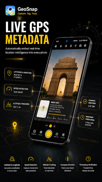
Get on Google PlayCapture photos with automatic GPS coordinates, latitude, longitude, address, altitude, and compass direction.
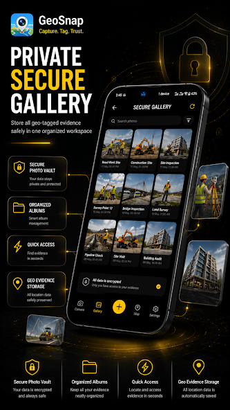
Include live map previews and geolocation overlays directly on your images for clear field documentation.
Display customizable timestamps for accurate documentation and proof of capture.
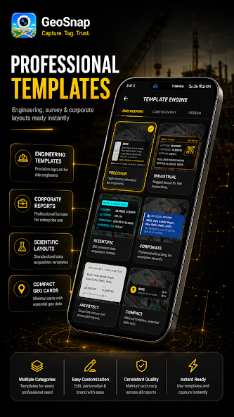
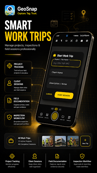
Generate professional PDF reports with geotagged photos for inspections, engineering projects, and surveys.
Choose from multiple clean templates designed for field reports and site verification workflows.
Share GPS-stamped images instantly with clients, teams, and colleagues. EXIF GPS metadata supported.
Swipe to browse screenshots
GeoSnap processes geotagging information locally on your device. Your photos and location data are not shared with third parties without your consent. No data collected · No data shared with third parties.
Available on Google Play. Capture every moment with precise GPS location and professional overlays.